
Walk a Cottonwood Heights Street Record by Record
A Cottonwood Heights street directory search begins with an official address, not a guessed name. County Addressing uses frontage number, directional, street name or number, street type, and an optional unit or suffix. The current Assessor can then return owner, parcel, situs and mailing fields. GIS checks the parcel boundary and nearby lots. Recorder instruments add the legal trail, while voter and directory sources provide dated context where their access rules permit.
- Normalize house number, direction, street type, unit, ZIP, and historical spelling with County Addressing.
- Search the Assessor by address, owner, or parcel, then save owner and mailing fields separately.
- Open the Parcel Viewer, click the parcel, and note adjacent IDs, subdivision, lot/block, tax district, and map layers.
- Use the Recorder index to follow the legal description, instrument date, grantor, grantee, and recording number.
- Use public voter fields, planning packets, permits, or reverse directories only as dated supporting evidence.
Cottonwood Heights Records Keyed to an Address
The street directory chain is a set of connected records, not one master roll. Parcel numbers bridge the Assessor, GIS, Recorder, plats, and some city files. The street name helps you find the starting point, but the legal description controls a deed match. A voter file can include public residential and mailing addresses, precinct, status, party, age range, and vote history, yet the full file is fee-based and subject to Utah use restrictions.
| Record Set | Keeper | What It Shows | Access |
|---|---|---|---|
| Assessor parcel | Salt Lake County Assessor | Owner, situs/mailing, value, traits, exemptions | Free current search |
| GIS map | County Assessor GIS | Boundaries, layers, tax districts, imagery | Free viewer |
| Deeds and plats | Salt Lake County Recorder | Grantor, grantee, legal parcel, transfer dates | Index free; copies and images vary |
| Voter file | Utah elections system | Public address, status, precinct, party, vote history | $1,050 file; restricted use |
| Planning and permits | Cottonwood Heights | Applicants, addresses, project and hearing dates | Recent packets online; older via GRAMA |
| Street files | Salt Lake County Addressing | Range, direction, ZIP, jurisdiction, changes | Free monthly files; no names |
Use the parcel as the spine. Then note each source’s date and purpose. A planning applicant may be a representative, a deed grantee may be a trust or estate, and a mailing address may sit outside the city. Those are useful facts, but they require careful labels.
What a Cottonwood Heights Street Directory Leaves Out
A street directory cannot show every person who uses an address. The reviewed sources do not provide private utility or customer lists. DMV personal information is restricted by the federal Driver’s Privacy Protection Act. Household members may not appear in property, voter, deed, or city records. Sealed court parties, protected vital records, Safe at Home participants, and at-risk voters can be intentionally absent.
Lawful use. Cottonwood Heights address records are for narrow personal, family-history, civic, or safety research. Do not use them to stalk, harass, threaten, or intimidate another person.
Assessor Fields for Street Searches
The legacy Salt Lake County Assessor query is especially useful for a street directory because it accepts more address pieces than a simple name search. Use a frontage number or street name, direction, street type or direction, owner name, parcel prefix, and result sorting as the live form allows. The current parcel search also accepts owner last and first name, address autocomplete, and the full parcel format.
| Field | Street use |
|---|---|
| Frontage or house number | Starts a number or street search and narrows a range. |
| Directional | Standardizes N, S, E, or W before comparing records. |
| Street name and type | Separates similar roads and older abbreviations. |
| Owner name | Moves from a known person to parcel-linked results. |
| Parcel number or prefix | Full format identifies a parcel; legacy prefixes can narrow an area or block. |
The county says the first seven parcel digits can find a block under legacy instructions. Verify the live interface before treating that as a fixed decoding rule.
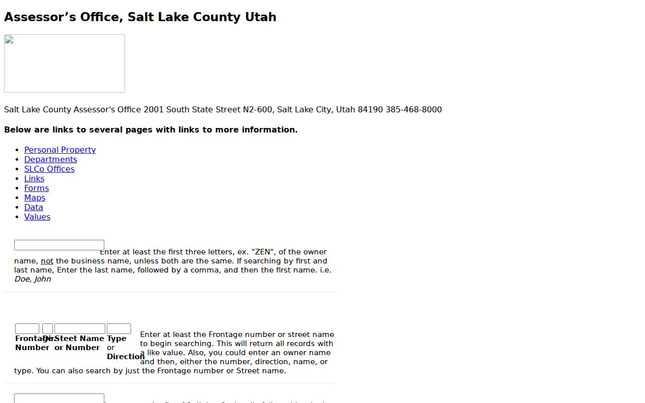
The Salt Lake County legacy Assessor search shows the address and owner controls used to build a street-level parcel list.
Read the Parcel Viewer Along a Street
The GIS Parcel Viewer adds geography that a text result cannot. Locate an address or parcel, zoom until boundaries are clear, click each selected parcel, and record its ID, situs, subdivision or lot/block context, tax district, and layers. Aerial and oblique imagery can add visual context, but imagery dates vary. Zoning and land-use layers describe regulation, not who lives at a property.
The official GIS description says parcel IDs come from the Recorder and land identity may also rest in a written description or recorded plat. For an adjacent-lot question, use the map to identify parcels first, then return to the Assessor and Recorder. Do not claim a radius tool unless the live map displays one.
Monthly Salt Lake County Street Files
County Addressing publishes street text files with street name, type, direction, low and high coordinate values, range, ZIP, and jurisdiction code. Monthly change files can show additions, deletions, and edits. They contain no resident names, but they help normalize a street before a parcel search and can flag a change that needs a plat or affidavit.
No Cottonwood Heights-specific street renumbering or renaming year was verified. Search the current form, historical subdivision name, older jurisdiction, and legal description. The city assigns addresses within its jurisdiction while county Addressing coordinates standards and validates countywide address points.
Planning Packets as Address Clues
Cottonwood Heights Planning Commission packets and city notices can name applicants, representatives, hearing dates, and parcel addresses. The online archive covers six months; older material goes through GRAMA. Building permits use the dynamic iWorq system, with plans and payment before review and inspections tied to a numeric permit number. The research did not confirm a public permit-name search or a code-enforcement lookup.
City GRAMA fees include copy, certification, media, archived-retrieval, and research or redaction charges. Ask for a defined address, date range, and packet type. A planning name is a public filing role, not a statement that the person occupies the parcel.
Older Streets in Polk Pink Pages
Post-1924 Polk directories generally offer an address-based “pink page” method through the Utah Historical Society Research Center. Search the street, number, direction, and older place label. Pre-1924 volumes may require the name section first, followed by a newspaper, Recorder, Assessor, or preservation-file cross-check. Preserve the scan, page, publisher, and year because OCR can distort names.
Cottonwood Heights was county territory before 2005. Greenfield Village, Cottonwood Ridge, Steffensen Heights, Virginia Hills Drive, and the 7000 South/Highland Drive area can be better historical search terms than the modern city name.
Build a Street Evidence Table
A useful street directory output is a compact evidence ledger. It keeps present parcel facts, historical associations, and public-record events in separate columns. Record the source URL and search date beside each row.
- Official address and historical form.
- Parcel number, legal description, subdivision, lot, and block.
- Situs, mailing address, owner of record, and Assessor fields.
- Recorder instrument number, date, grantor, grantee, and document type.
- Planning, permit, voter, or directory source with its own date and limits.
This format prevents a current tax field from being silently turned into a claim about all people on a street.
Read the Recorder Entry Carefully
The Recorder’s grantor-grantee index is the bridge between a street directory and a legal parcel. A field-level entry may include instrument date and type, grantor, grantee, filing date, property description, volume/page or electronic number, consideration or fee-book details, and image access. Deeds, trust deeds, releases, liens, and plats do not all carry the same information.
Salt Lake County warns that the public property search is informational and does not replace a title search. A public image may require Data Services access, and the exact online cutoff was not stated. If a street result matters, save the search terms and request the document by party names, date, type, and recording key.
Street Names Are Not Land Identity
Cottonwood Heights uses county grid conventions, but older records may use an abbreviation, a subdivision name, or a former jurisdiction. County Addressing reports more than 540,000 address points and publishes monthly street changes, yet no verified Cottonwood Heights readdressing year was found. A changed street string should be bridged with a plat, affidavit, parcel history, or legal description.
Keep a historical form beside the standardized form. This small step catches records filed under Salt Lake County, Holladay, East Millcreek, or suburban Salt Lake before the city’s incorporation.
Label Each Street Result
Use “owner of record,” “mailing address,” “planning applicant,” or “historical directory entry” as the result label. Avoid the single word “resident” when the source shows only a parcel or filing role. A narrow label protects accuracy and makes a later search easier to repeat.
Include the exact source, date accessed, and any protection or coverage note. Address work is strongest when another researcher can follow the same street-to-parcel-to-record path.